Our Favorite Things to Do in and around Greenville, SC
How to Use This Guide
We’ve organized our favorite Greenville-area destinations by distance from downtown, then category within each band. The logic is simple: figure out how much time you have, pick a distance band, then choose what kind of outing you’re in the mood for.
| Distance Band | Drive Time | Best For |
|---|---|---|
| In Town (0–5 mi) | 1–5 min | Quick walk, bike, or spontaneous outing |
| Local Upstate (5–30 mi) | 10–45 min | Afternoon trip, easy evening |
| Regional Upstate (30–60 mi) | 45 min–1.5 hr | Half-day adventure |
| Western NC & North Georgia (60–100 mi) | 1.5–2.5 hr | Full-day trip |
| Extended Day Trip (100–200 mi) | 2.5–3 hr | Leave-early day trip |
All distances are road driving miles from downtown Greenville. Drive times reflect typical conditions on paved roads — some mountain destinations involve gravel roads that may add time in wet conditions. Every destination on this list is within a comfortable day trip.
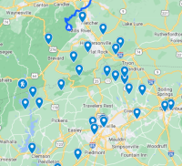
The map above has all locations pinned. Expand it, click on any place icon to see pictures and a detailed description. Each destination below also links to its Google Maps location for navigation.
Table of Contents
- In Town (0-5 mi)
- Local Upstate (5-30 mi)
- Regional Upstate (30-60 mi)
- Western NC and North Georgia (60-100 mi)
- Extended Day Trip (100-200 mi)
In Town (0-5 mi)
13 destinations. Just minutes from downtown — these are walkable, bikeable, or a quick drive.
Outdoor Adventure
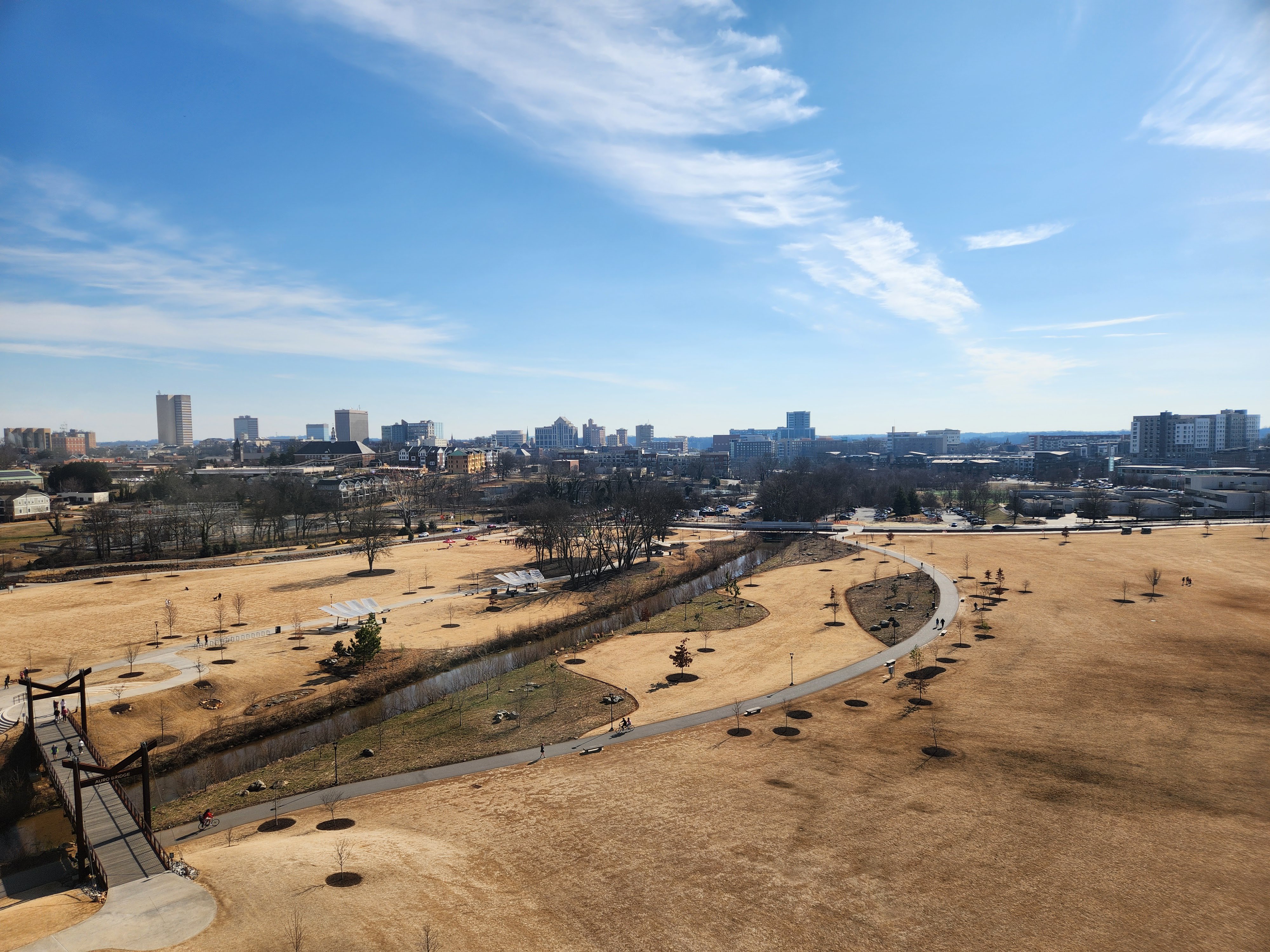
Bike/Walk Swamp Rabbit Trail from Unity Park — 1.3 mi, 3m
Free parking, easy walk into downtown. The Swamp Rabbit Trail is a 22-mile multi-use path connecting Greenville, Travelers Rest, and Falls Park. Google Maps
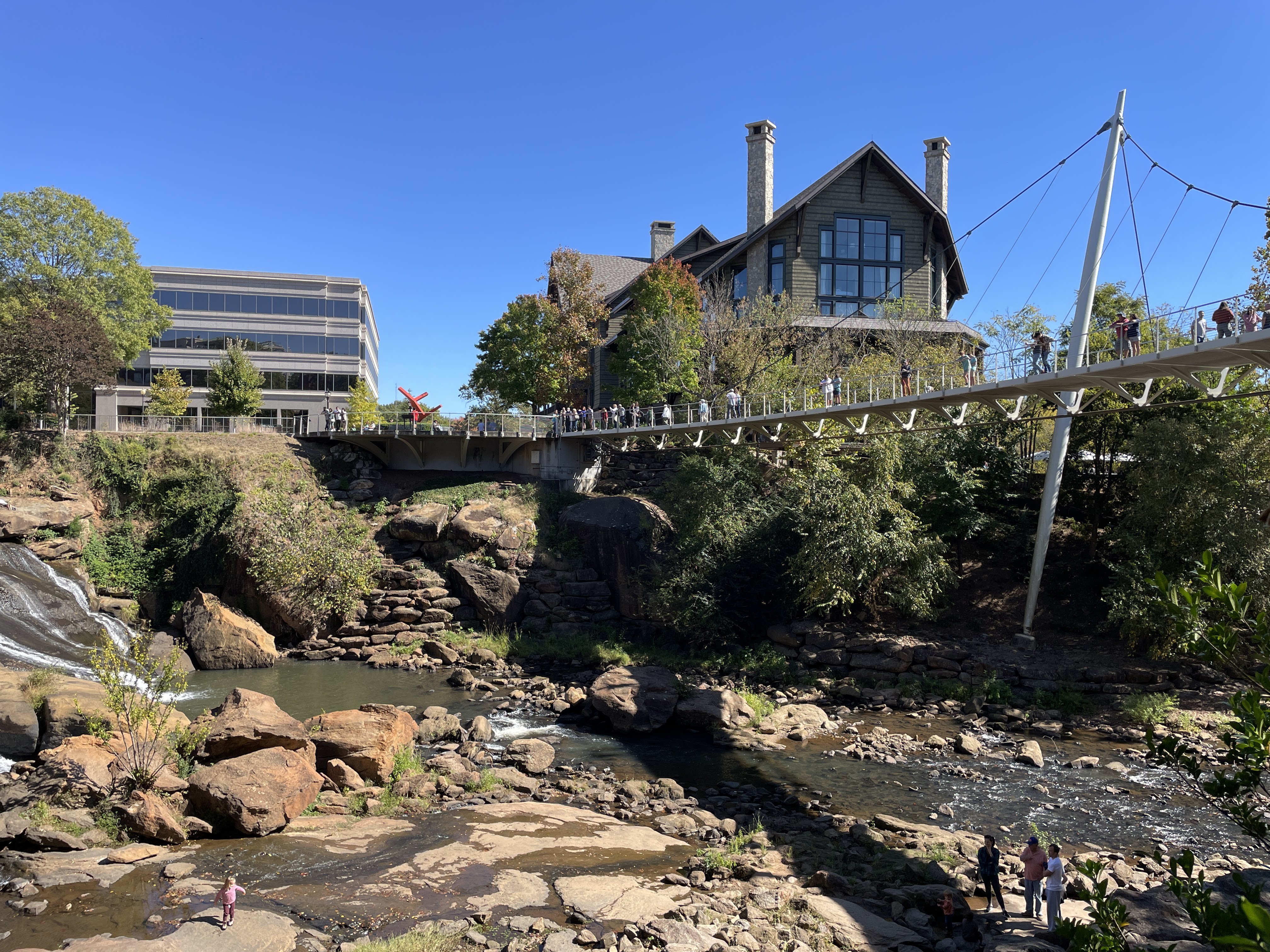
Falls Park on the Reedy — 1.3 mi, 4m
A downtown Greenville waterfall view, best known for the views from Liberty Bridge. Google Maps
Rock Quarry Garden — 1.9 mi, 5m
A small but scenic waterfall tucked into the gardens of Cleveland Park. Google Maps
Food & Drink
Jeni’s Splendid Ice Creams — 0.6 mi, 1m
Located in downtown Greenville, Jeni’s is famous for its unique, artisanal flavors and smooth, buttercream-like texture. Google Maps
Soby’s — 0.6 mi, 2m
A cornerstone of Greenville’s dining scene, serving modern Southern cuisine with local ingredients in a vibrant, renovated cotton warehouse. Google Maps
Lewis Barbecue — 1.0 mi, 2m
Legendary Texas-style BBQ comes to the Upstate. Famous for its melt-in-your-mouth brisket and industrial-chic outdoor seating area. Google Maps
Community Tap Trailside — 1.6 mi, 4m
Located right on the Swamp Rabbit Trail, this spot offers a curated selection of craft beers and wines in a relaxed, family-friendly atmosphere. Google Maps
Landmarks & Scenic
Liberty Bridge — 1.5 mi, 4m
A unique curved suspension bridge in Falls Park on the Reedy. It offers an amazing view of the waterfalls in the heart of downtown Greenville. Google Maps
Family Fun
Breakout Games — 0.6 mi, 1m
An escape room experience in downtown Greenville. Multiple themed rooms with challenging puzzles for groups of 2-8. Google Maps
Greenville Zoo — 1.0 mi, 2m
A 14-acre zoo located in Cleveland Park. It is home to giraffes, lions, primates, and reptiles, making it a perfectly manageable outing for families. Google Maps
Fluor Field (Greenville Drive) — 1.4 mi, 3m
Home of the Greenville Drive. This mini-Fenway Park is a staple of downtown life, offering affordable family fun and great views of the game. Google Maps
Arts & Culture
M. Judson Booksellers — 0.6 mi, 1m
A community hub in Greenville’s historic courthouse building. Browse a curated selection of books while enjoying a treat from the in-house cafe. Google Maps
Artisphere — 1.2 mi, 3m
An annual street art fair held in downtown Greenville each May. Features juried artists, live music, and local food. Google Maps
Local Upstate (5-30 mi)
23 destinations. A short drive through the Upstate countryside. These are perfect for a spontaneous afternoon outing.
Outdoor Adventure
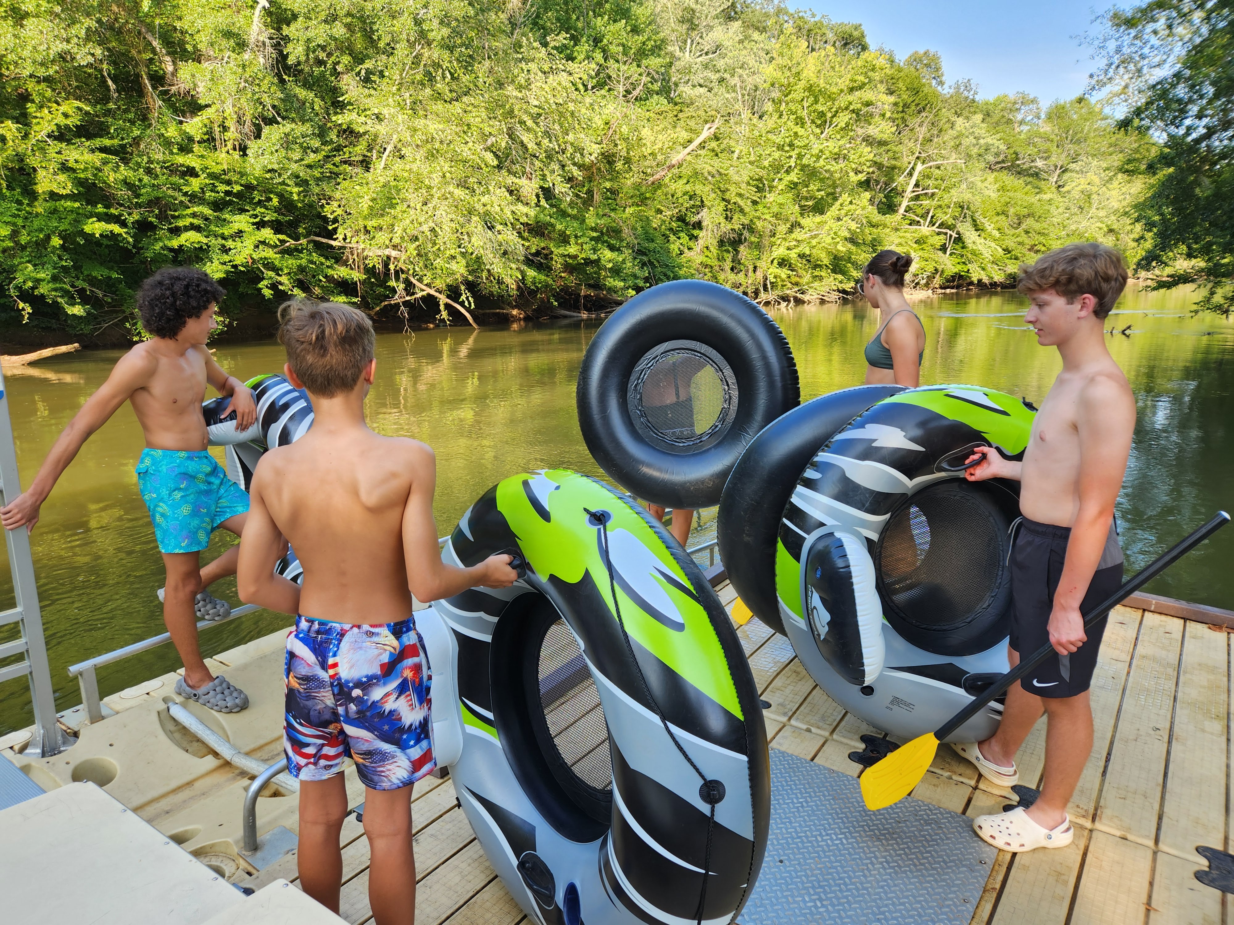
Tube the Saluda — 5.6 mi, 11m
Relaxed tubing on the Saluda River through Greenville. Multiple access points; Dolly Cooper Park offers the best public put-in/take-out with a dedicated tubing loop. Google Maps
Tubing Loop on Saluda (Dolly Cooper Park) — 6.8 mi, 15m
Designated tubing loop at Dolly Cooper Park — park, tube the loop, walk back upstream on the paved trail, repeat. Family-friendly, free parking. Google Maps
Paris Mountain State Park — 6.9 mi, 15m
Hiking and mountain biking. Just 15 minutes from downtown Greenville, this park offers 15 miles of trails, a lake for swimming, and excellent mountain biking. Google Maps
Cedar Shoals — 19.4 mi, 31m
Here the Reedy River spreads wide and tumbles over rocks and boulders. Google Maps
Wildcat Wayside — 21.4 mi, 41m
Between Caesars Head and Jones Gap, a short but steep staircase takes you to the top of a 130-foot waterfall. Google Maps
Pleasant Ridge — 21.7 mi, 40m
A kid-friendly, 1-mile trail through Pleasant Ridge County Park leads to a waterfall framed by lush foliage. Google Maps
Jones Gap — 22.5 mi, 42m
A 1-mile hike with shallow pools leads to a 50-foot waterfall descending over a rocky staircase into the Middle Saluda River. Google Maps
Food & Drink
Napoli Pizzeria — 10.8 mi, 17m
Best lasagna, manicotti, soups. A local Italian spot in Greenville that’s been serving up hearty portions for years. Google Maps
Sweet Basil Thai Cuisine — 11.1 mi, 17m
A local favorite for authentic Thai flavors, offering everything from spicy curries to classic Pad Thai in a welcoming, modern setting. Google Maps
Sushi Masa Japanese Restaurant — 11.2 mi, 17m
A go-to spot for fresh sushi and traditional Japanese fare. Known for its consistent quality and friendly service among Greenville locals. Google Maps
La Taverna — 26.9 mi, 38m
An intimate spot serving authentic, traditional Italian dishes. Known for its warm atmosphere and high-quality ingredients in the heart of the Upstate. Google Maps
The Beacon Drive-in — 29.6 mi, 43m
A Spartanburg legend known for its “A-Plenty” meals (piles of onion rings and fries) and world-famous iced tea. A true Southern landmark. Google Maps
Landmarks & Scenic
Campbell’s Covered Bridge — 22.9 mi, 41m
This historic red structure and the surrounding park offer a picturesque spot for photos and picnics. Google Maps
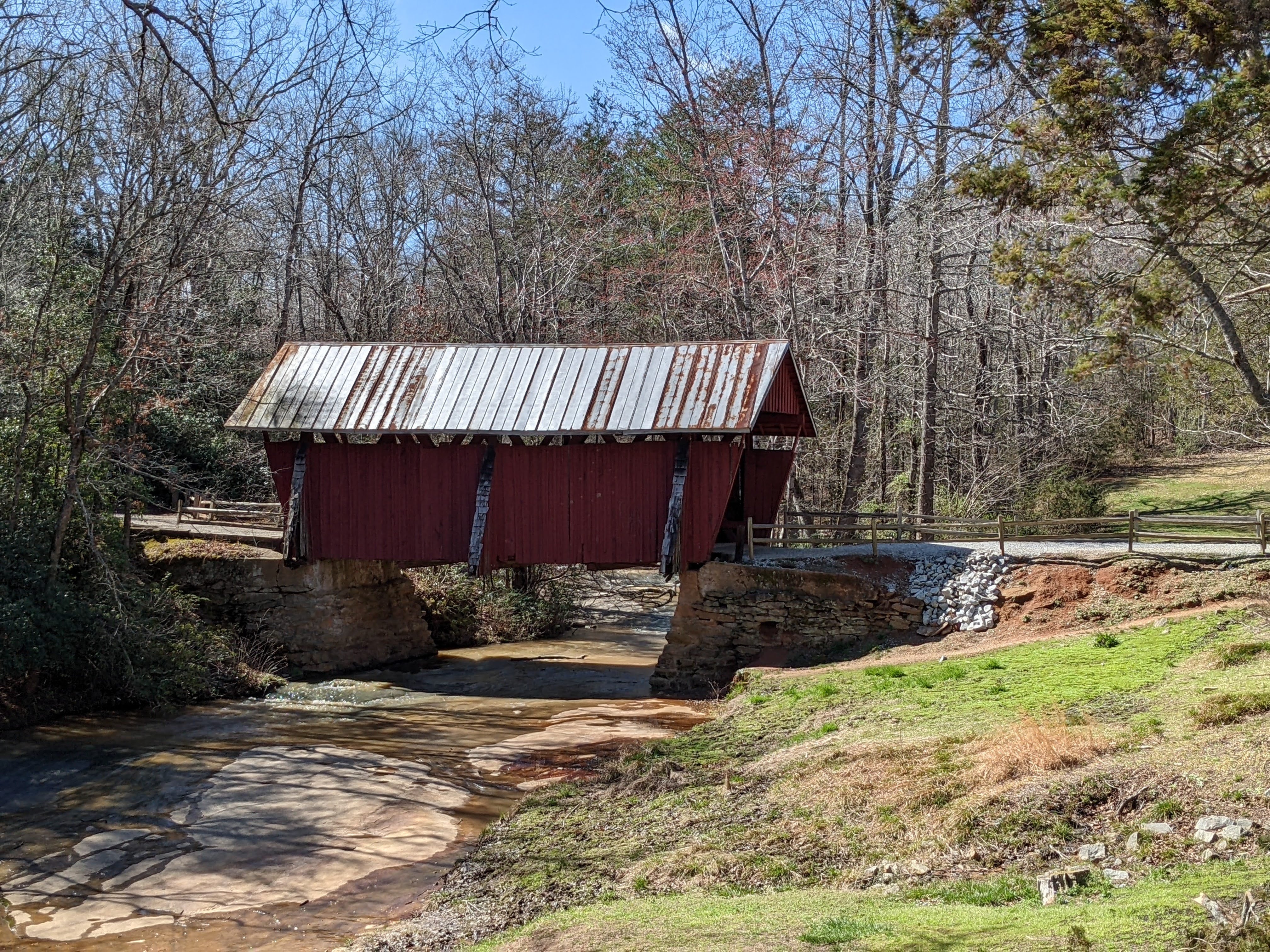
Ballenger’s Covered Bridge — 23.4 mi, 40m
A beautiful historic landmark nestled in the Upstate. While privately owned, it remains a favorite subject for local photographers and history buffs. Google Maps
Poinsett Bridge — 23.9 mi, 40m
Oldest bridge in SC. Built in 1820, this stone arch bridge is the oldest surviving bridge in South Carolina and a National Register landmark. Google Maps
Klickety-Klack Covered Bridge — 25.7 mi, 43m
A charming, privately owned covered bridge located in the Cliffs communities, known for its rustic look and the sound it makes when driven over. Google Maps
Family Fun
Big Air Trampoline Park — 7.2 mi, 11m
A high-energy indoor park featuring wall-to-wall trampolines, foam pits, ninja courses, and dodgeball for kids of all ages. Google Maps
BMW Tour — 15.5 mi, 27m
Go behind the scenes at the only BMW factory in the US. Watch the “Ultimate Driving Machine” come to life during a guided tour of the high-tech facility. Google Maps
Fishers Orchard — 17.5 mi, 35m
Pick your own peaches in July at this family-owned orchard. A classic Upstate summer tradition. Google Maps
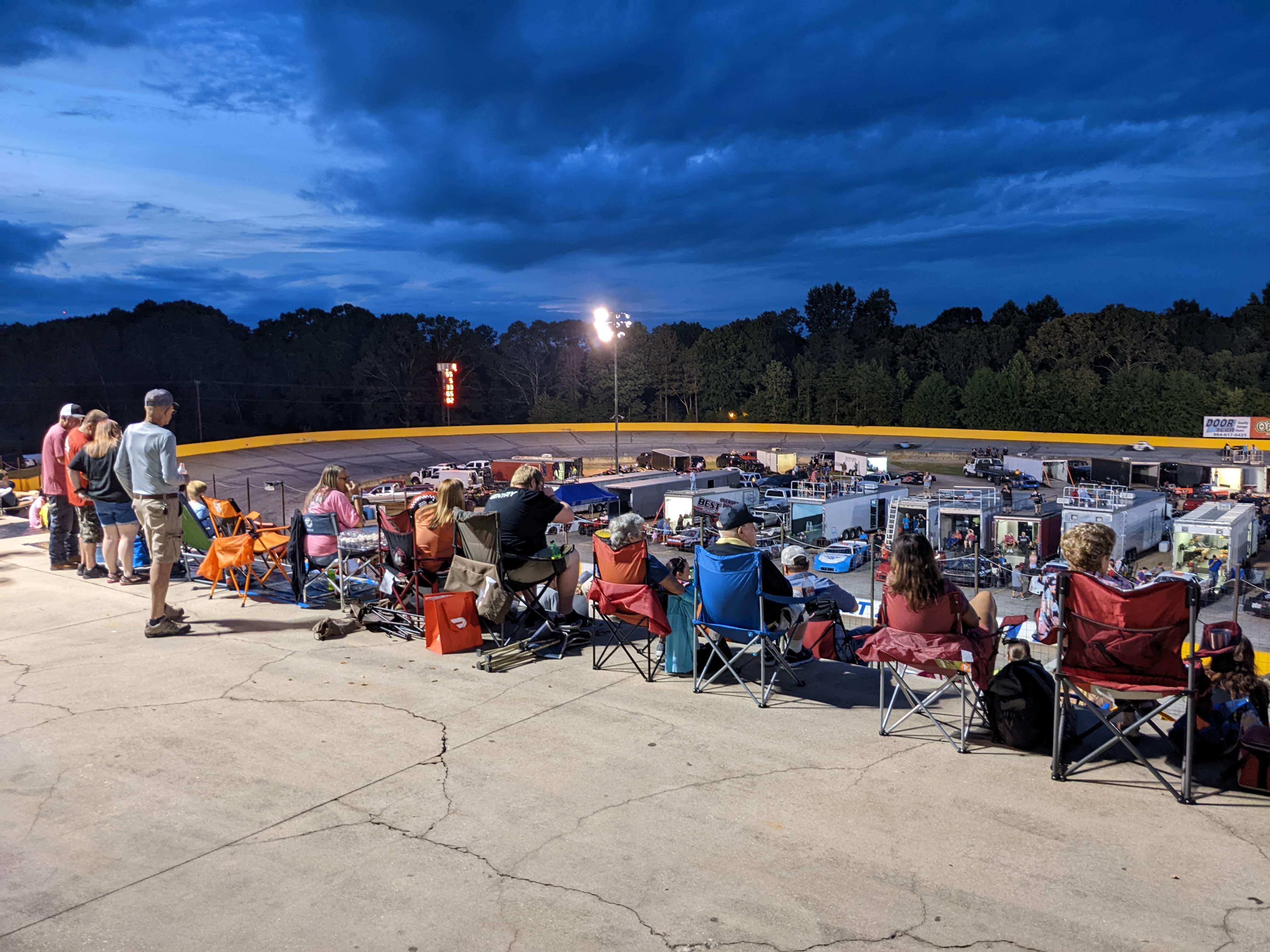
Anderson Motor Speedway — 18.8 mi, 32m
Bring a chair, a cooler, and ear protection. A 3/8-mile oval track hosting weekly stock car racing — a true local motorsports experience. Google Maps
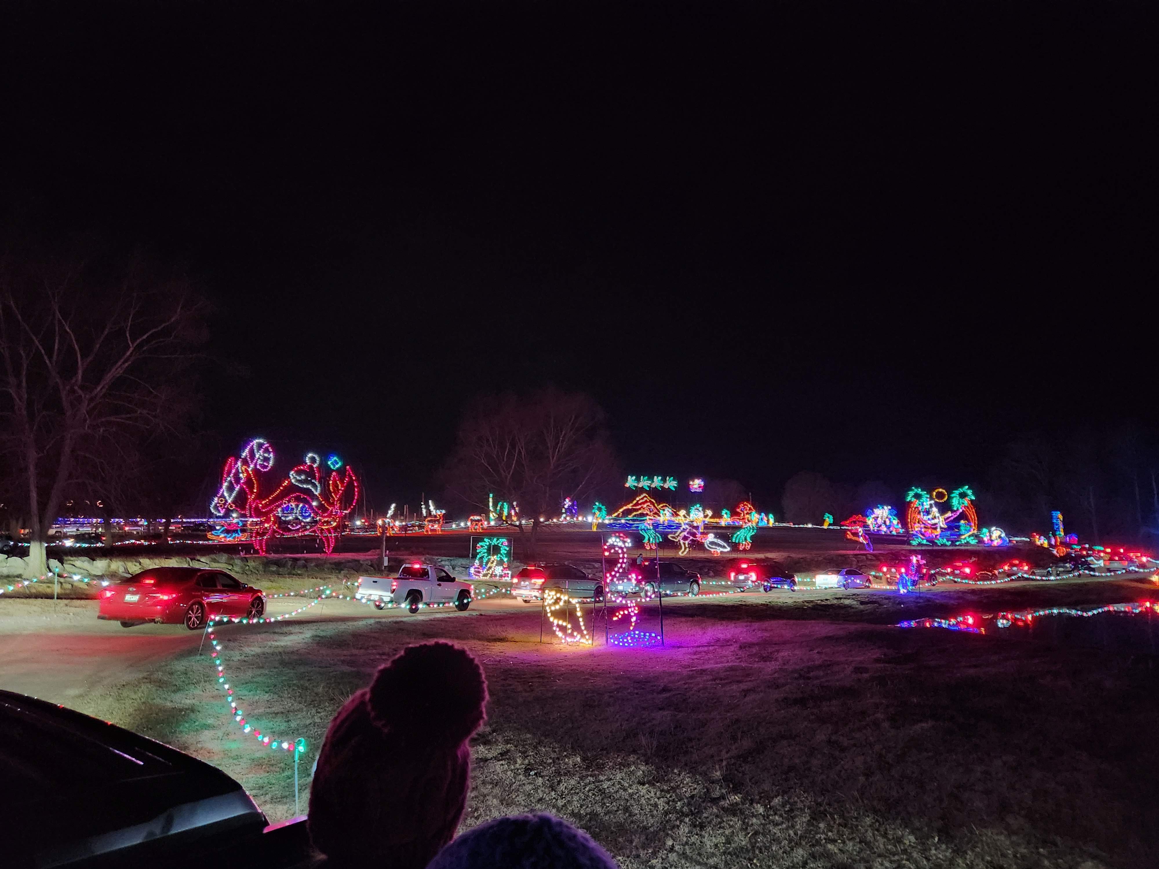
Hollywild Animal Preserve — 20.9 mi, 40m
A drive-through holiday tradition featuring millions of lights and the “Enchanted Deer Forest” where you can feed animals from your car. Google Maps
Denver Downs — 28.9 mi, 39m
A premier fall destination featuring a massive corn maze, pumpkin patches, live music, and over 30 fun activities for kids and adults alike. Google Maps
Arts & Culture
Roper Mountain Science Center — 5.8 mi, 10m
An educational destination featuring a planetarium, arboretum, and living history farm. Google Maps
Regional Upstate (30-60 mi)
28 destinations. The heart of Upstate SC and into the southern Blue Ridge foothills. Worth setting aside a half-day to explore.
Outdoor Adventure
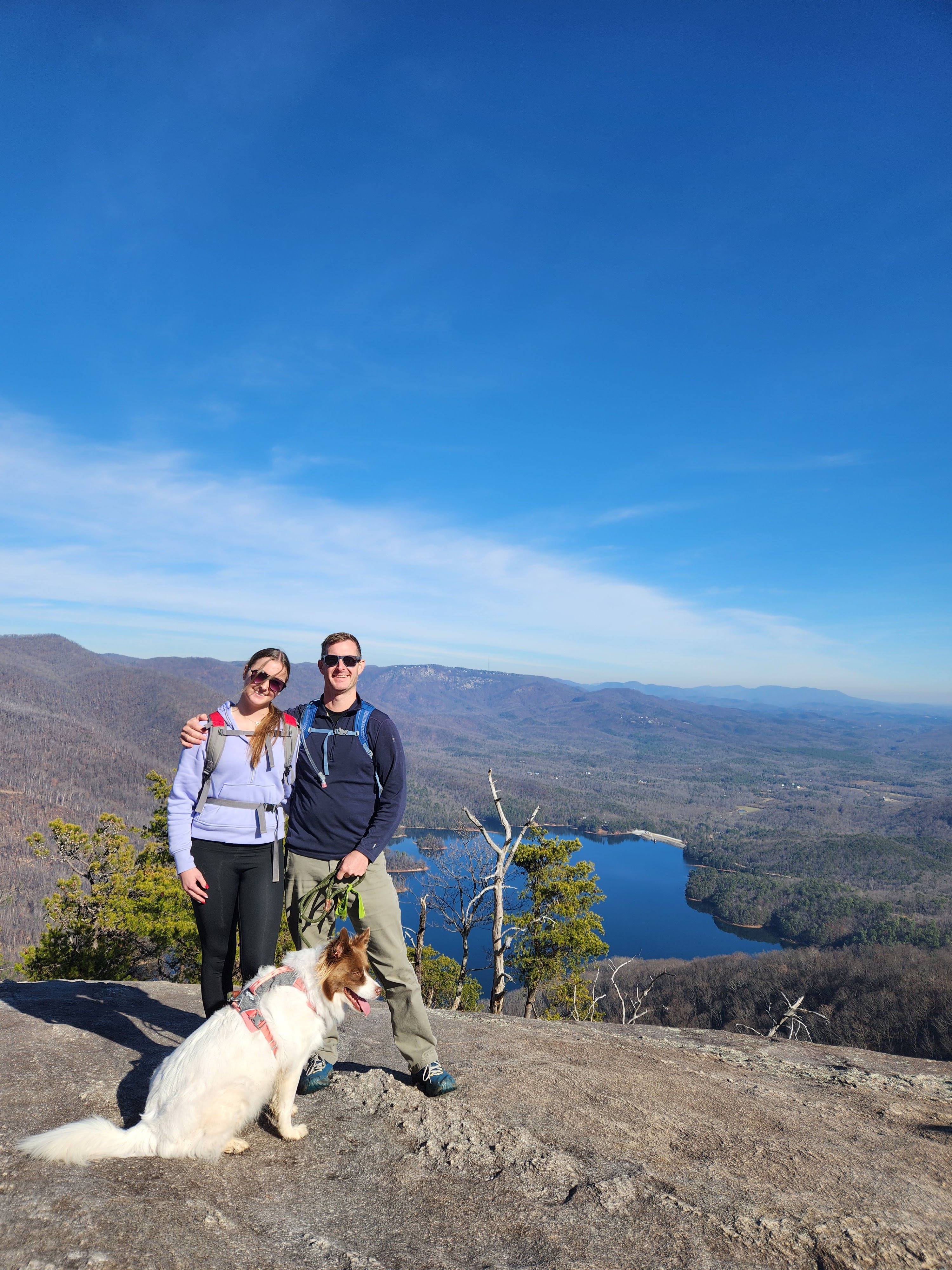
Table Rock Reservoir Overlook Hike — 30.5 mi, 1h 04m
8 miles round trip, ~3 hours. A moderate hike with rewarding views of Table Rock Reservoir and the surrounding mountains. Google Maps
Long Shoals Roadside Park — 34.4 mi, 54m
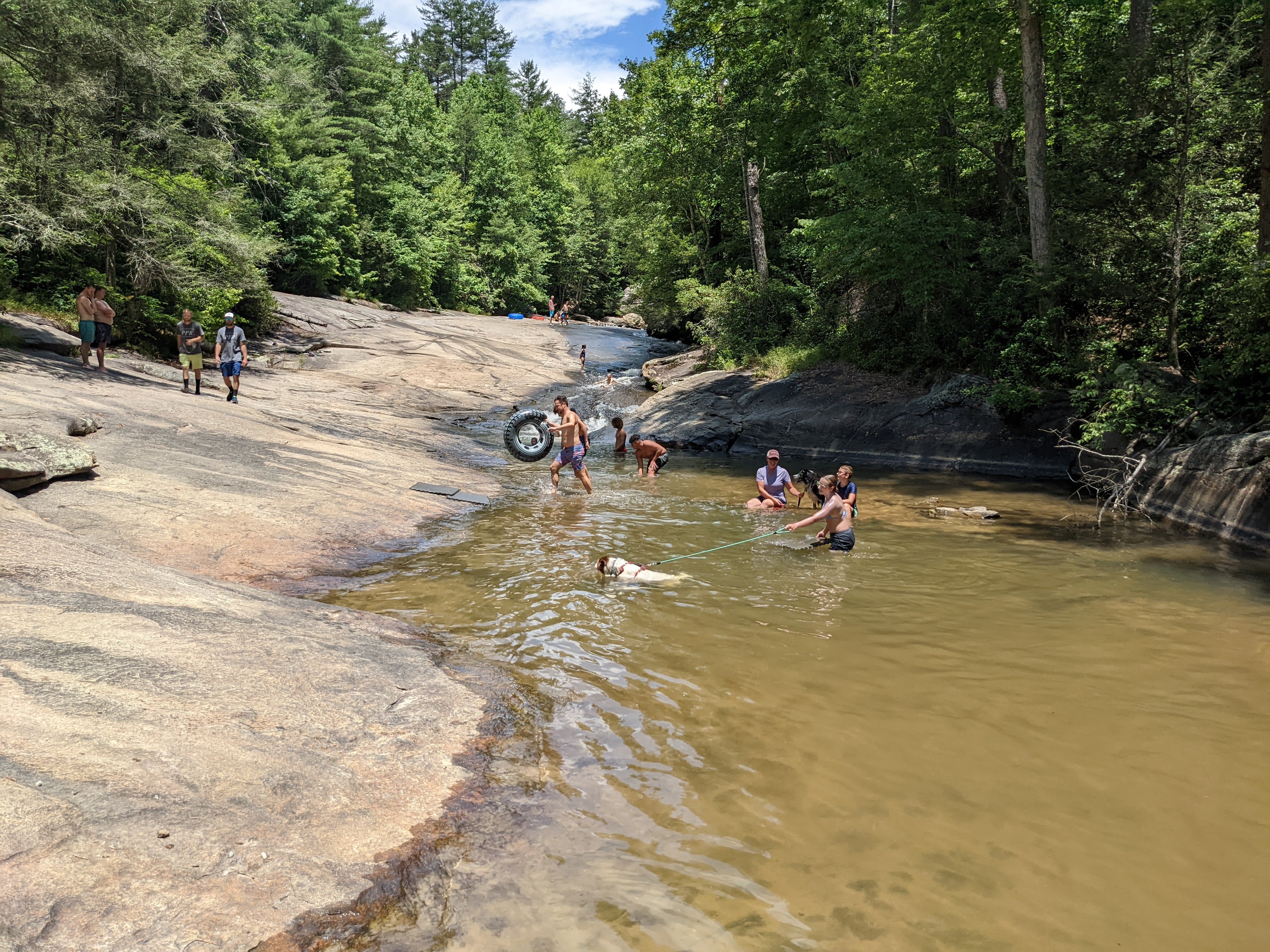
A developed roadside park on Little Eastatoee Creek off SC-11 near Sunset. 15-ft natural rock slide, wading pools, short walk from parking. Locals call it “Sliding Rock.” No facilities. Water shoes recommended. Best late spring–fall. Google Maps
Twin — 35.7 mi, 1h 05m
Also called Reedy Cove Falls, Rock Falls, and Eastatoe Falls; its twin cascades meet in a shallow pool, with the left side dropping about 75 feet over granite. Google Maps
Jocassee Pontoon Boat Rental Waterfall Tour — 38.5 mi, 1h 06m
Great way to enjoy a lake day and to get to see the many waterfalls that empty into the lake. $550/day. See our full trip report: Scuba Diving and Falls Tour on Lake Jocassee — includes GPS coordinates for the Chinese Junk Sailboat wreck. Google Maps
Ride Kanuga Bike Park — 39.6 mi, 1h 05m
A premier destination for mountain bikers featuring downhill trails, skills parks, and jump lines designed for all levels, located just outside Hendersonville. Google Maps
The Gorge Zipline — 39.9 mi, 57m
Best zipline we’ve done. Multiple ziplines across the gorge, including the longest in the area. The property also features hiking trails and a mountain coaster. Ziplining in Ecuador was another level, though. Google Maps
Laurel Fork — 40.0 mi, 1h 16m
A challenging 8-mile trek, usually 5 to 6 hours, ends with an 80-foot waterfall plunging into Lake Jocassee. Google Maps
Mountain Bike DuPont State Forest — 40.8 mi, 1h 11m
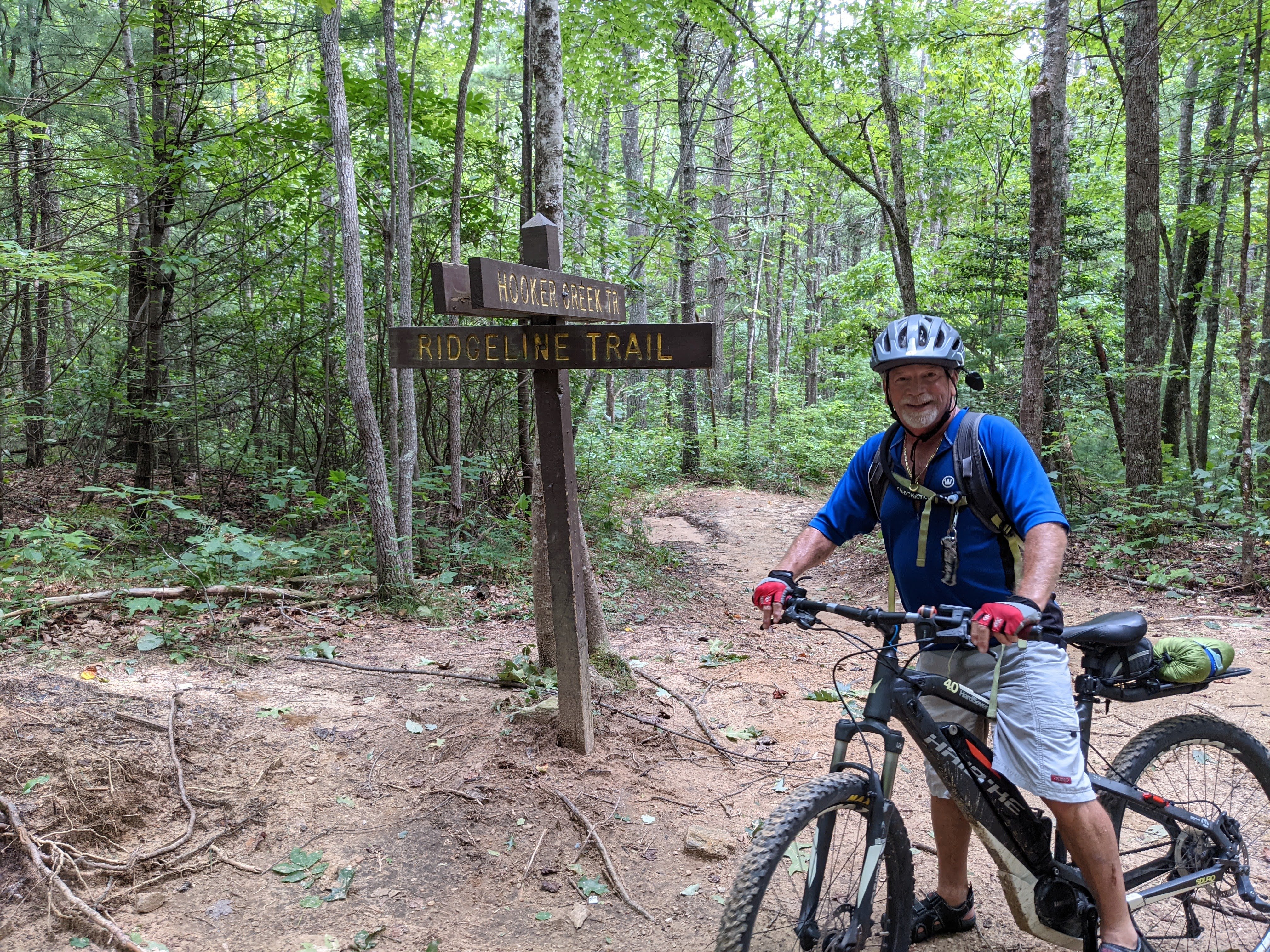
This is the parking lot for Ridgeline Trail. DuPont State Forest features over 80 miles of trails for all skill levels, including the popular Ridgeline, Jim Branch, and Big Rock trails. Google Maps
Lake Jocassee Waterfalls — 41.6 mi, 1h 22m
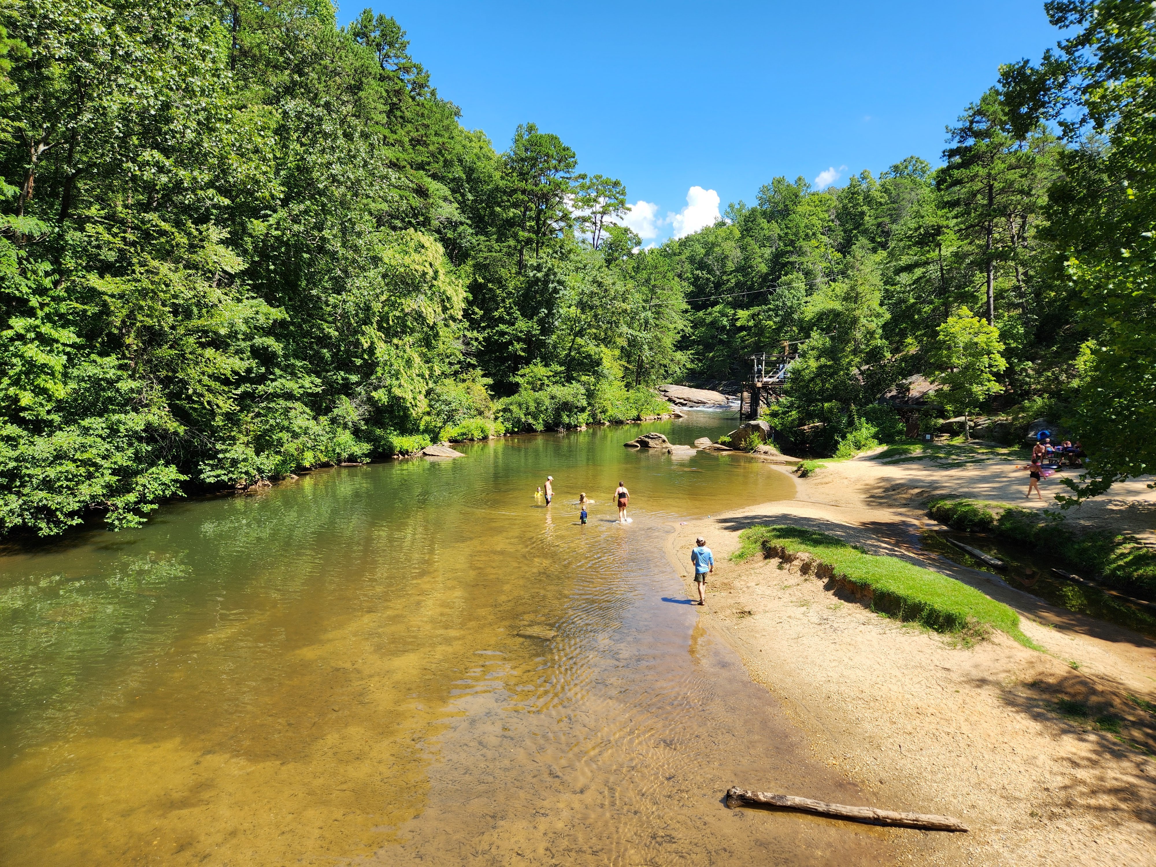
Multiple waterfalls pour into the lake and can be reached by kayak, paddleboard, or boat from Devils Fork State Park. Google Maps
Tubing Green River — 44.7 mi, 1h 16m
Enjoy a relaxing or adventurous float down the Green River. Options range from calm family floats to sections with small rapids for a bit of excitement. Google Maps

Whitewater Falls — 49.2 mi, 1h 21m
Walk down the first set of stairs to the viewing landing. At 811 feet, it’s the highest waterfall in the Eastern US, with a stunning view from the accessible platform. Google Maps
Chau Ram County Park — 49.4 mi, 1h 17m
Great tubing run, float spots, picnic locations. The park sits on the Chauga River and offers camping, hiking, and a popular swimming area. Google Maps
Lower Whitewater — 51.1 mi, 1h 28m
A 2-mile hike leads to an overlook with a dramatic 200-foot drop and broad cascading water. Google Maps
Yellow Branch — 53.5 mi, 1h 31m
A moderately difficult hike of about an hour passes through hardwoods, creek bottoms, and steeper terrain to a 50-foot waterfall. Google Maps
Silver Run Falls Trailhead — 55.1 mi, 1h 28m
A short, easy walk leads to a beautiful 25-foot waterfall with a large sandy beach and a calm pool perfect for wading and swimming. Google Maps
Station Cove — 55.1 mi, 1h 29m
An easy half-mile walk in Sumter National Forest leads to a 60-foot waterfall near Station Mountain. Google Maps
King Creek — 56.3 mi, 1h 38m
About a mile past Spoonauger, this 70-foot waterfall fans in a U-shape; Burrells Ford Campground is nearby. Google Maps
Rainbow Falls — 56.5 mi, 1h 31m
A stunning 150-foot waterfall in Jones Gap State Park. The trail is strenuous but rewards hikers with mist and frequent rainbows in the afternoon sun. We hiked to Rainbow Falls and slid off Turtleback Falls during a Gorges State Park day trip with the kids. Google Maps
Turtleback Falls — 56.5 mi, 1h 31m
A popular 20-foot cliff jump at the top of Rainbow Falls. The pool below is deep enough for confident swimmers to jump in. Approach via the Gorges State Park trailhead. Gorges State Park day trip Google Maps
Spoonauger — 58.4 mi, 1h 53m
An easy 20-minute walk to a 50-foot waterfall in the Chattooga watershed, with a shallow area at the base for splashing. Google Maps
Food & Drink
Sierra Nevada Brewing Co. — 50.8 mi, 1h 12m
More than just a brewery; it’s a “Malt Disney” experience with incredible architecture, a full restaurant, a forest amphitheater, and tours. Google Maps
Landmarks & Scenic
Pretty Place (Symmes Chapel) — 39.1 mi, 1h 12m
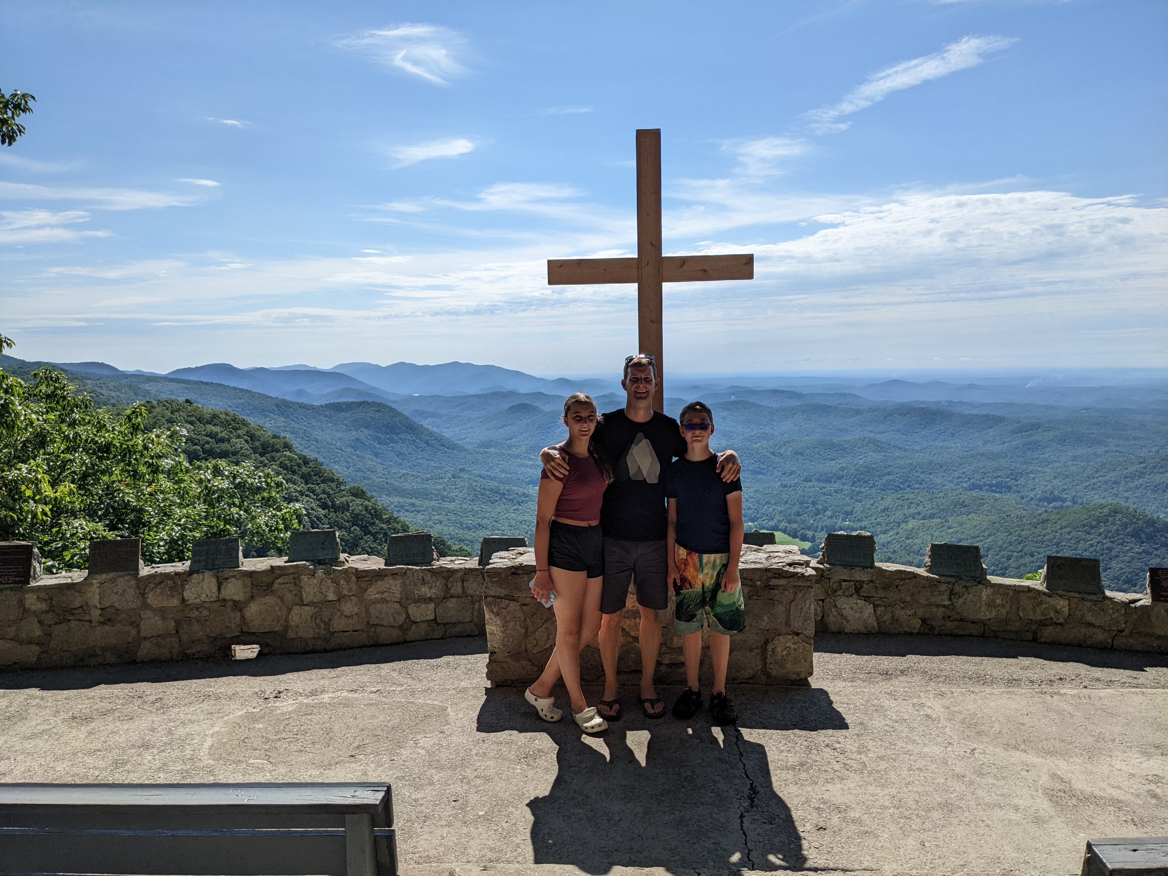
A breathtaking open-air chapel perched on the edge of a cliff, offering one of the most iconic sunrise views in the Blue Ridge Mountains. Part of YMCA Camp Greenville. Google Maps
Jumping Off Rock Overlook — 45.8 mi, 1h 50m
One of my favorite views in the state! Be prepared to drive miles of gravel road to get there. Google Maps
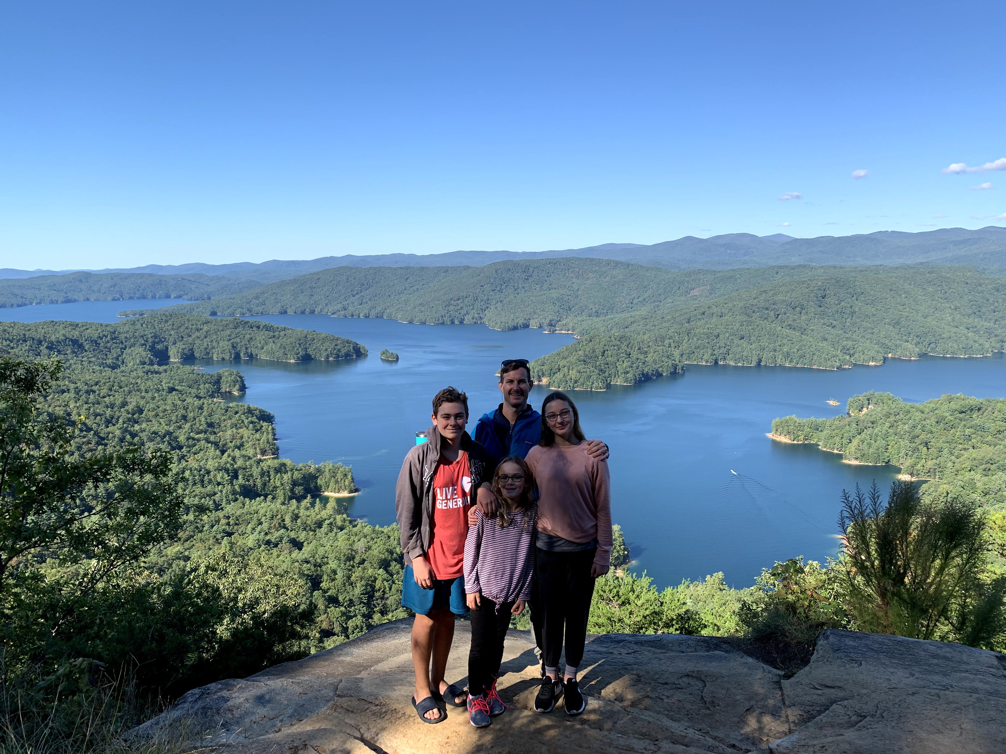
Scenic Overlook (Lake Jocassee) — 49.1 mi, 1h 21m
Overlooks Lake Jocassee in the distance. A short pull-off on the way to the lake with panoramic views of the surrounding mountains and water. Google Maps
Stumphouse Tunnel — 51.4 mi, 1h 21m
An incomplete 19th-century railroad tunnel that stays 50 degrees year-round. Explore the dark passage and visit the nearby Isaqueena Falls. Google Maps
Blue Ridge Parkway to Omni Grove Inn — 54.0 mi, 1h 16m
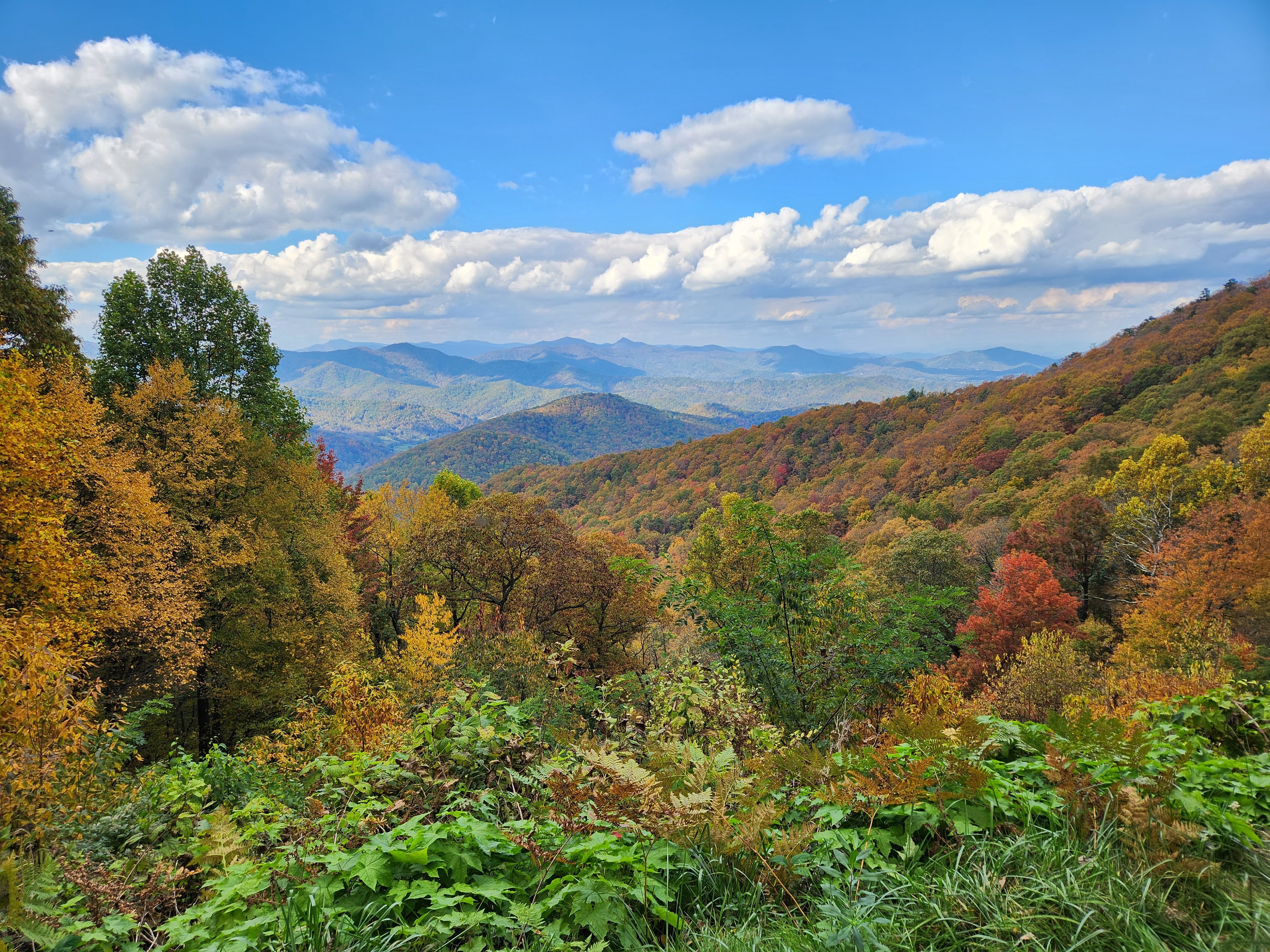
A scenic drive along America’s favorite Parkway leading to the historic Grove Park Inn. Perfect for leaf-peeping in the fall or enjoying mountain vistas. Google Maps
Family Fun
The Oasis Ranch Mini Golf — 34.0 mi, 50m
A beautifully landscaped 18-hole miniature golf course in Seneca, featuring botanical gardens and challenging holes for the whole family. Google Maps
Grandad’s Apples — 41.4 mi, 58m
A 100-acre family farm featuring a pumpkin patch, corn maze, and plenty of pre-picked or U-pick apples. Don’t miss the apple cider donuts! Google Maps
Western NC and North Georgia (60-100 mi)
11 destinations. Full-day trip territory. These destinations take you into the mountains of Western NC and North Georgia.
Outdoor Adventure
Cashiers Sliding Rock — 60.1 mi, 1h 42m
A smaller, more secluded natural water slide than its Pisgah counterpart. Great for kids and families looking for a quick dip in the mountains. Google Maps
Sliding Rock (Pisgah) — 61.2 mi, 1h 38m
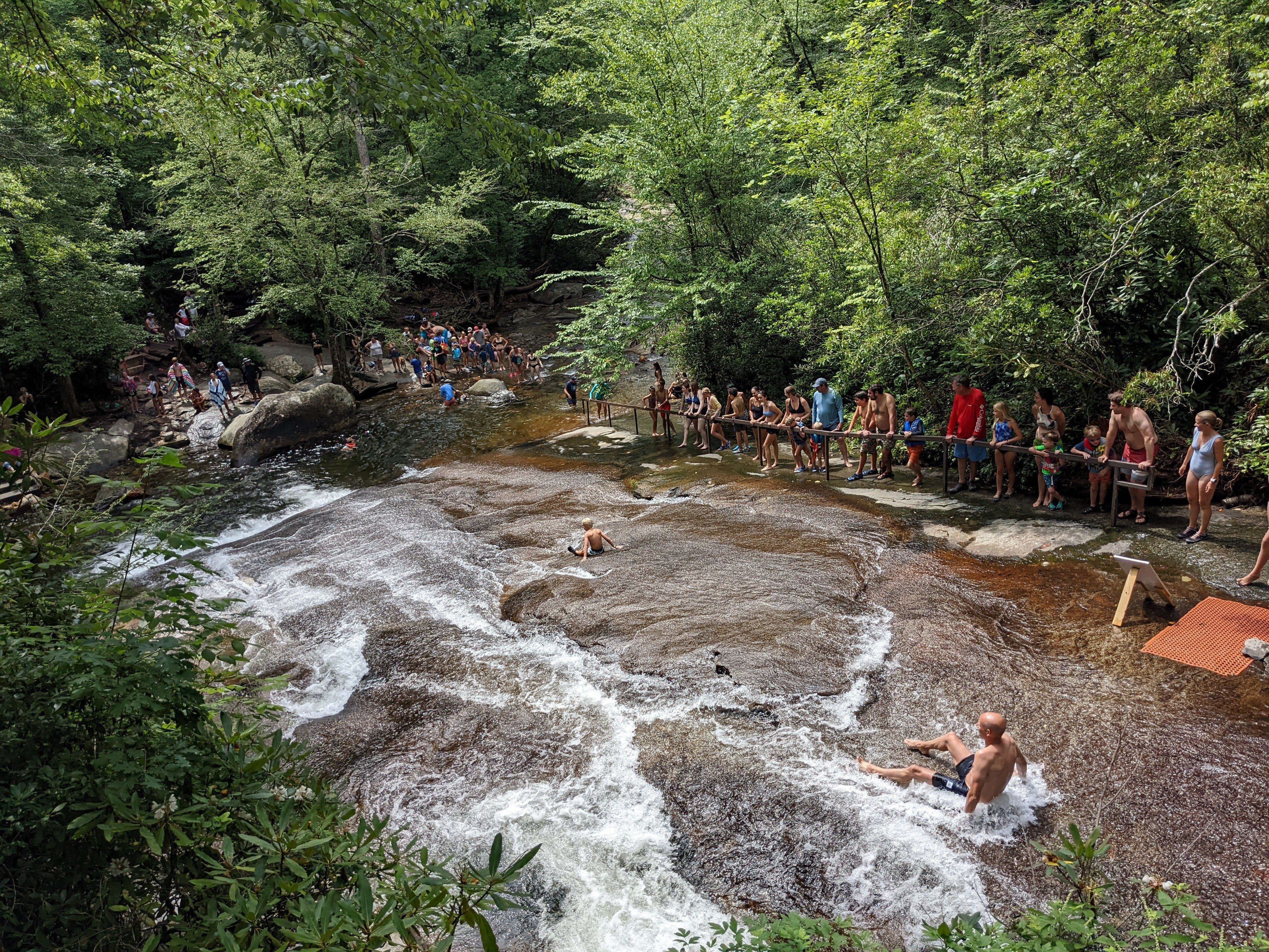
A natural 60-foot mountain water slide that ends in an 8-foot-deep pool. A classic Pisgah National Forest summer tradition for families and thrill-seekers. Google Maps
Duckies/Raft Chattooga River — 61.3 mi, 1h 32m
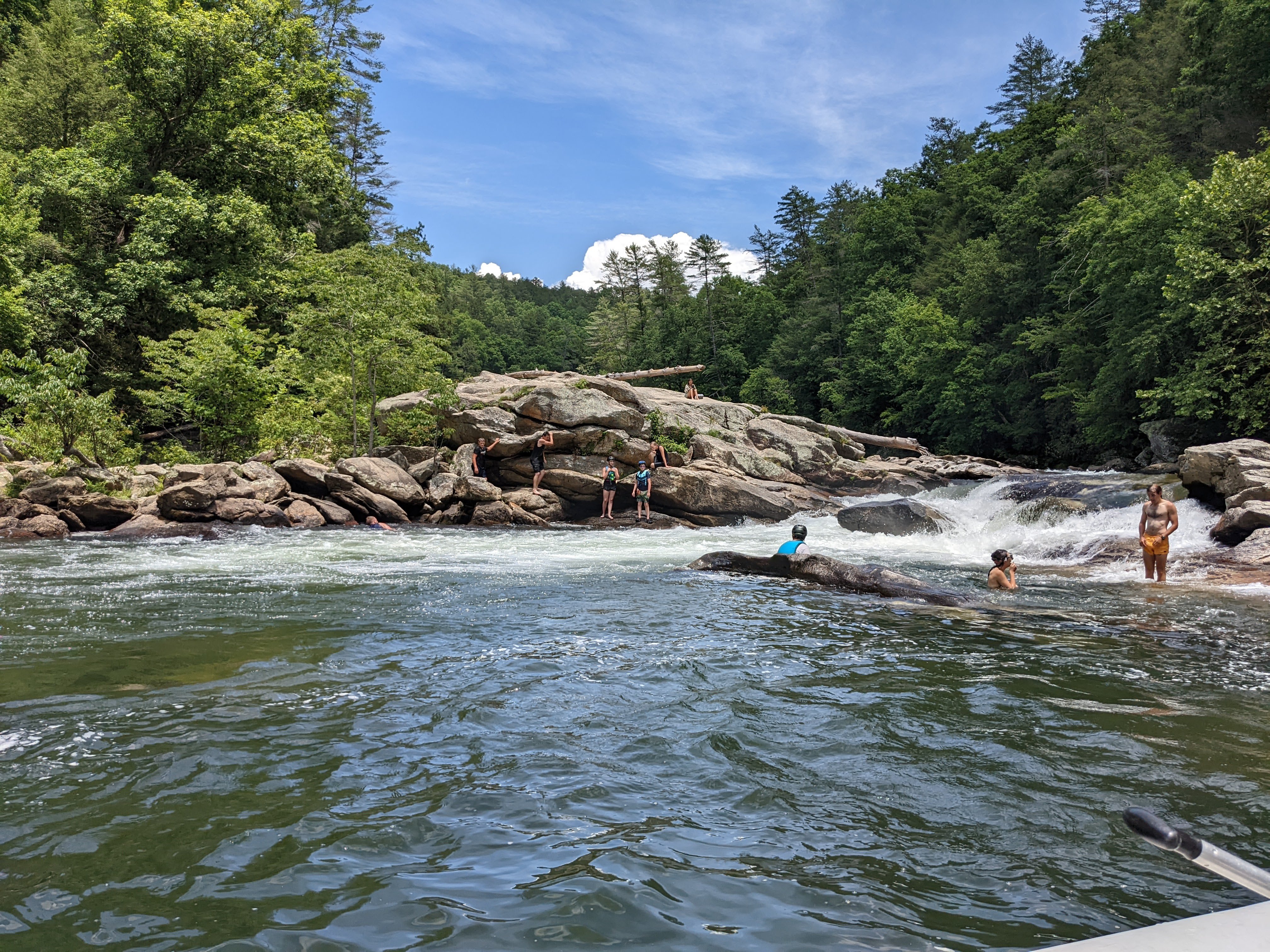
Experience the “Wild and Scenic” Chattooga River. Choose between guided whitewater rafting or inflatable kayaks (duckies) for a more personal challenge. Chattooga Fest 2022 Google Maps
Bull Sluice Rapid and Beach — 64.0 mi, 1h 36m
There is a beach just downstream of the rapid which is accessible from the same parking lot. Detailed rapid description and portage beta in Chattooga Fest 2022. Google Maps
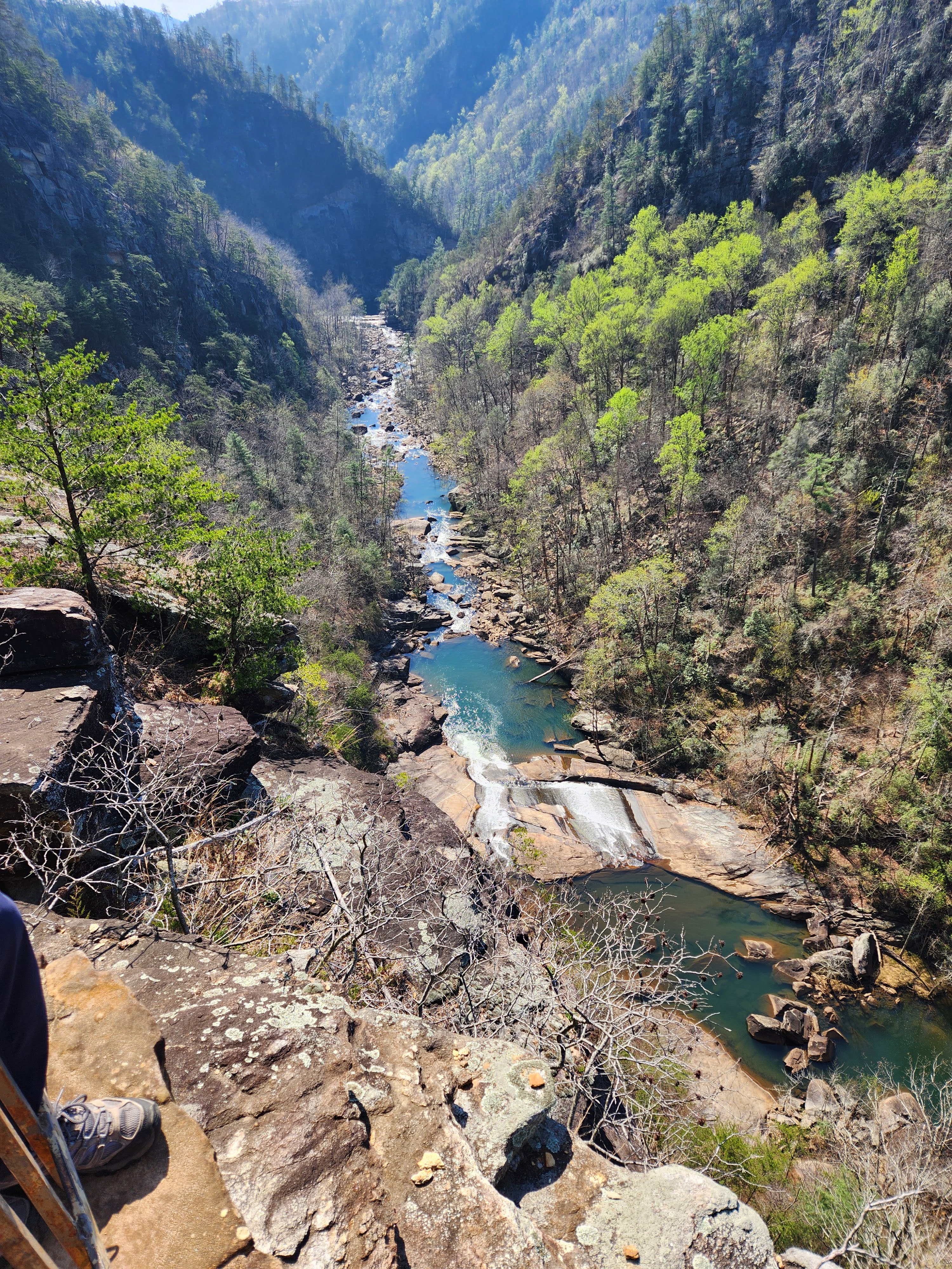
Tallulah Gorge State Park — 90.4 mi, 1h 55m
One of the most spectacular canyons in the Eastern US. Walk across the suspension bridge 80 feet above the rocky bottom or hike down to the gorge floor with a permit. Google Maps
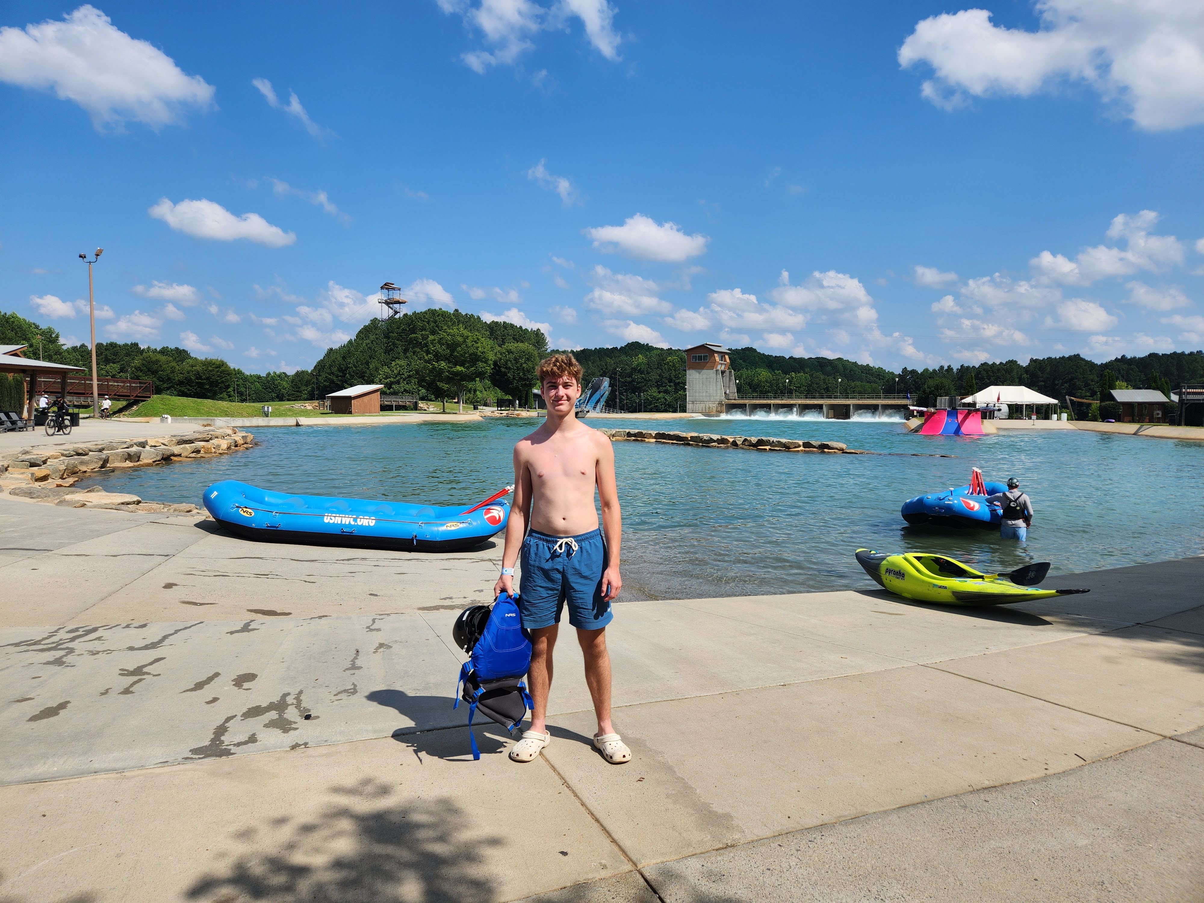
US National Whitewater Center — 96.4 mi, 2h 06m
Lots of outdoor activities. Located near Charlotte, this 1,300-acre facility offers whitewater rafting, kayaking, ziplines, mountain biking, and climbing. Google Maps
Food & Drink
New Belgium Brewing Company — 61.2 mi, 1h 23m
Situated along the French Broad River in Asheville, this brewery offers amazing liquid center tours, a huge lawn, and plenty of Fat Tire ale. Google Maps
French Broad Chocolate Lounge — 62.2 mi, 1h 24m
A must-visit in Asheville for dessert lovers. Indulge in artisanal truffles, liquid truffles, and incredible cakes in their cozy blue lounge. Google Maps
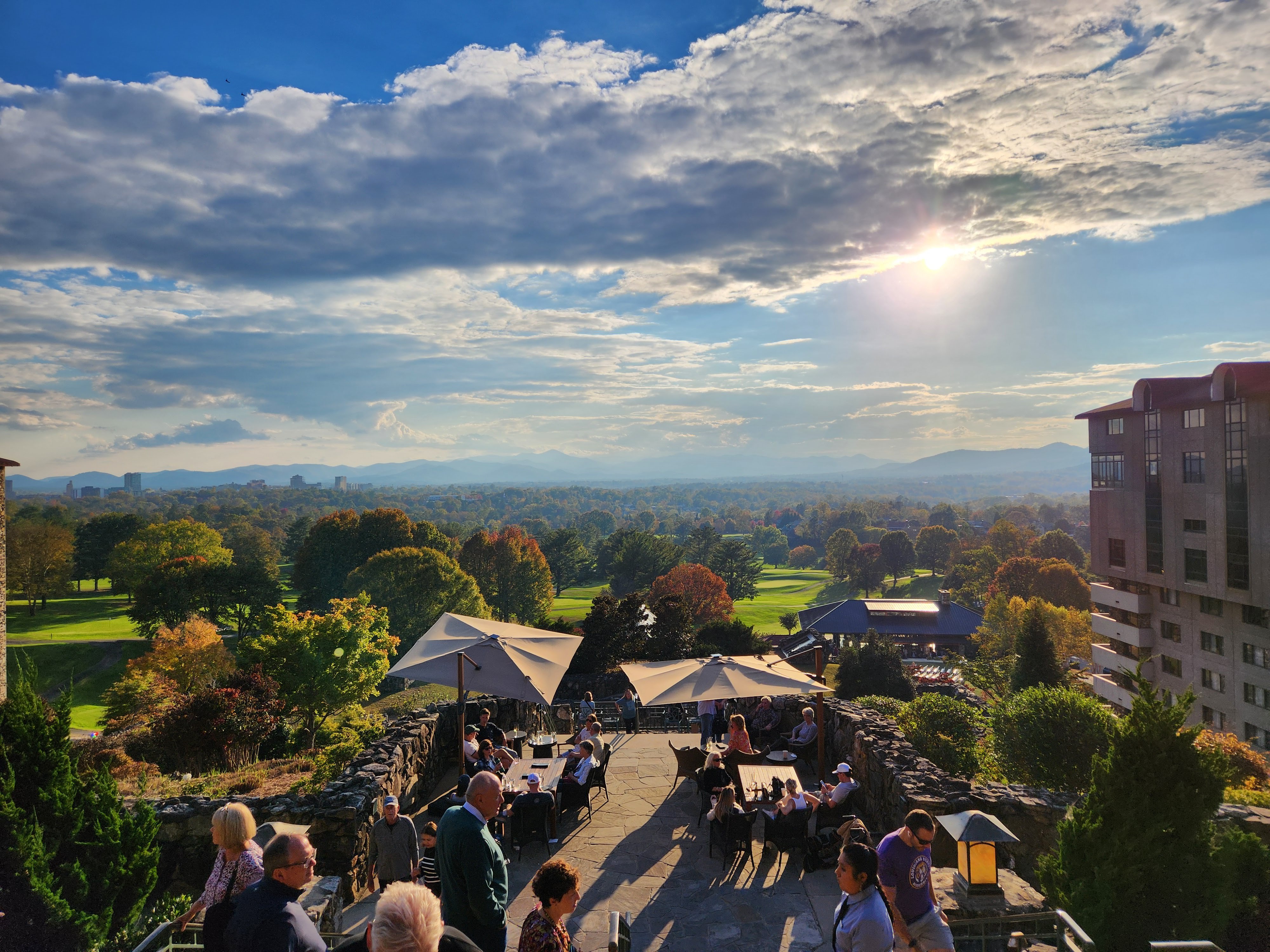
The Omni Grove Park Inn — 64.4 mi, 1h 30m
Have a drink and relax while taking in the views of Asheville. Winter has the gingerbread houses competition. Google Maps
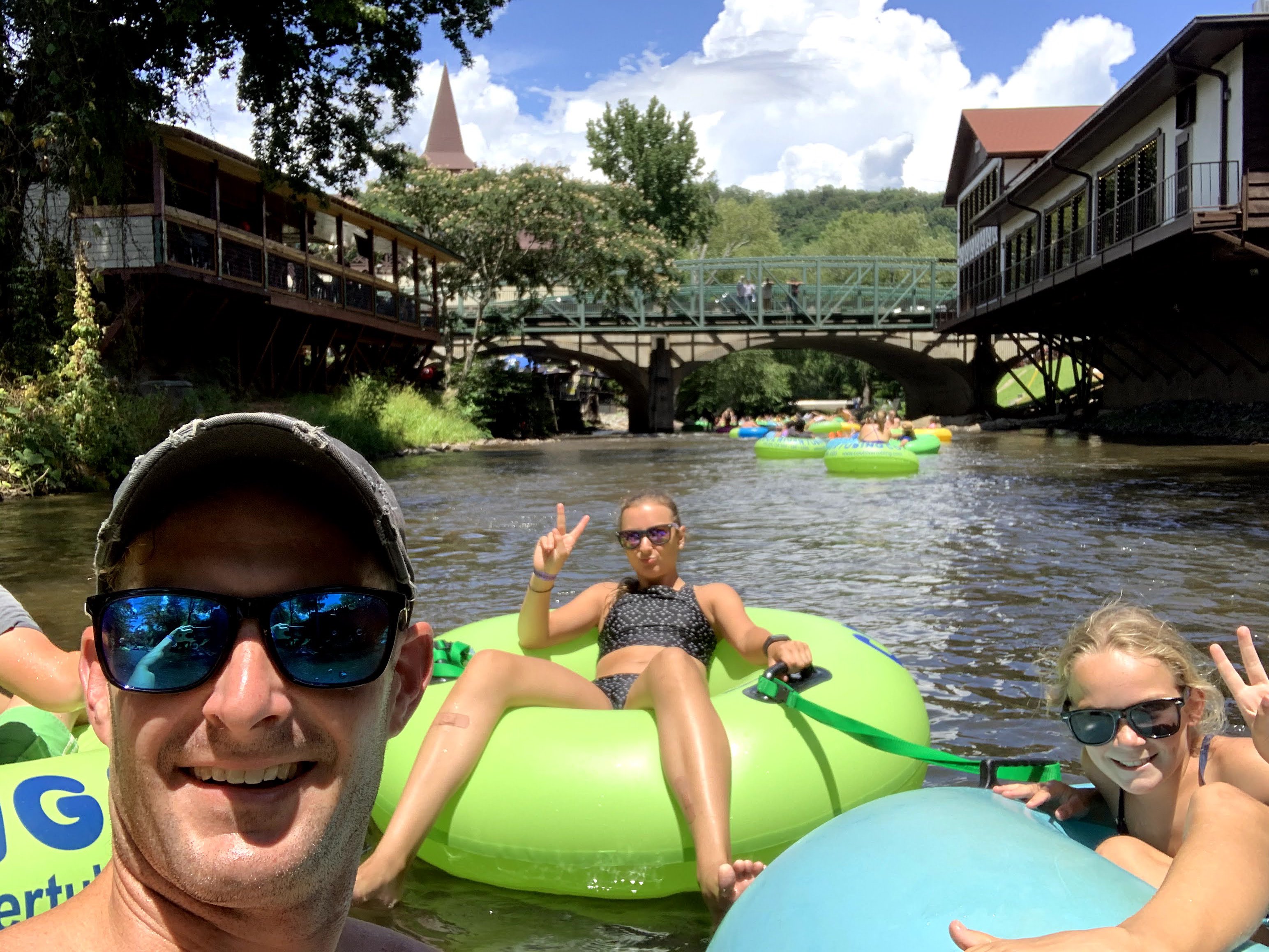
Helen (GA) — 98.9 mi, 2h 11m
Classic North Georgia mountain town. Tube the Chattahoochee River through downtown Helen (Alpine village theme), then explore shops, breweries, and German food. Google Maps
Landmarks & Scenic
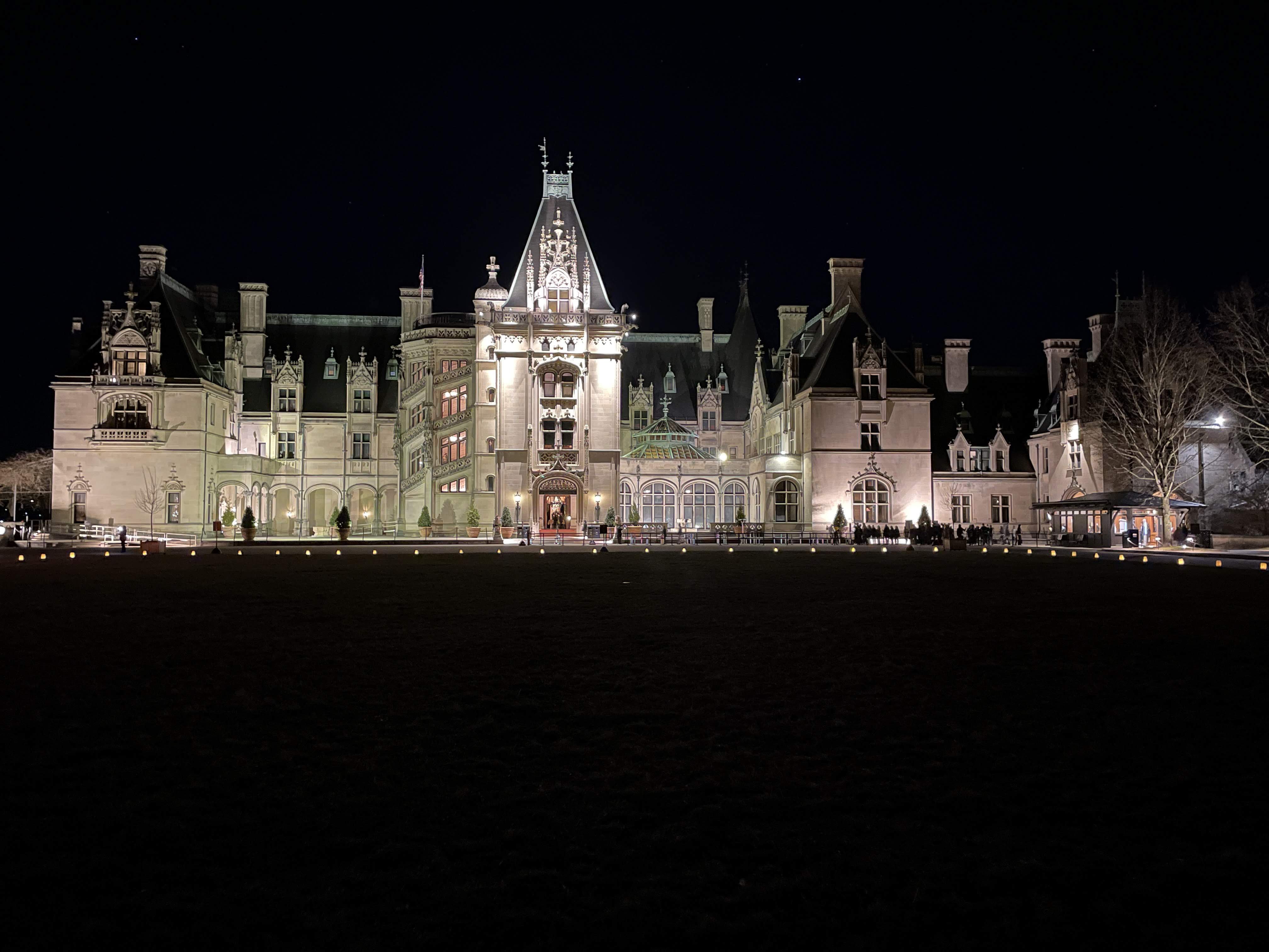
Biltmore Estate — 60.5 mi, 1h 33m
Explore George Vanderbilt’s 8,000-acre estate in Asheville, featuring America’s largest home, stunning gardens, and a world-class winery. Google Maps
Extended Day Trip (100-200 mi)
7 destinations. These are the farthest-flung destinations on our list — all within a comfortable day trip, but you’ll want to leave early and plan for the drive.
Outdoor Adventure
Max Patch — 100.2 mi, 2h 40m
A famous “bald” mountain on the Appalachian Trail providing 360-degree views of the Smokies and Blue Ridge. It is a premier spot for picnics and stargazing. Google Maps
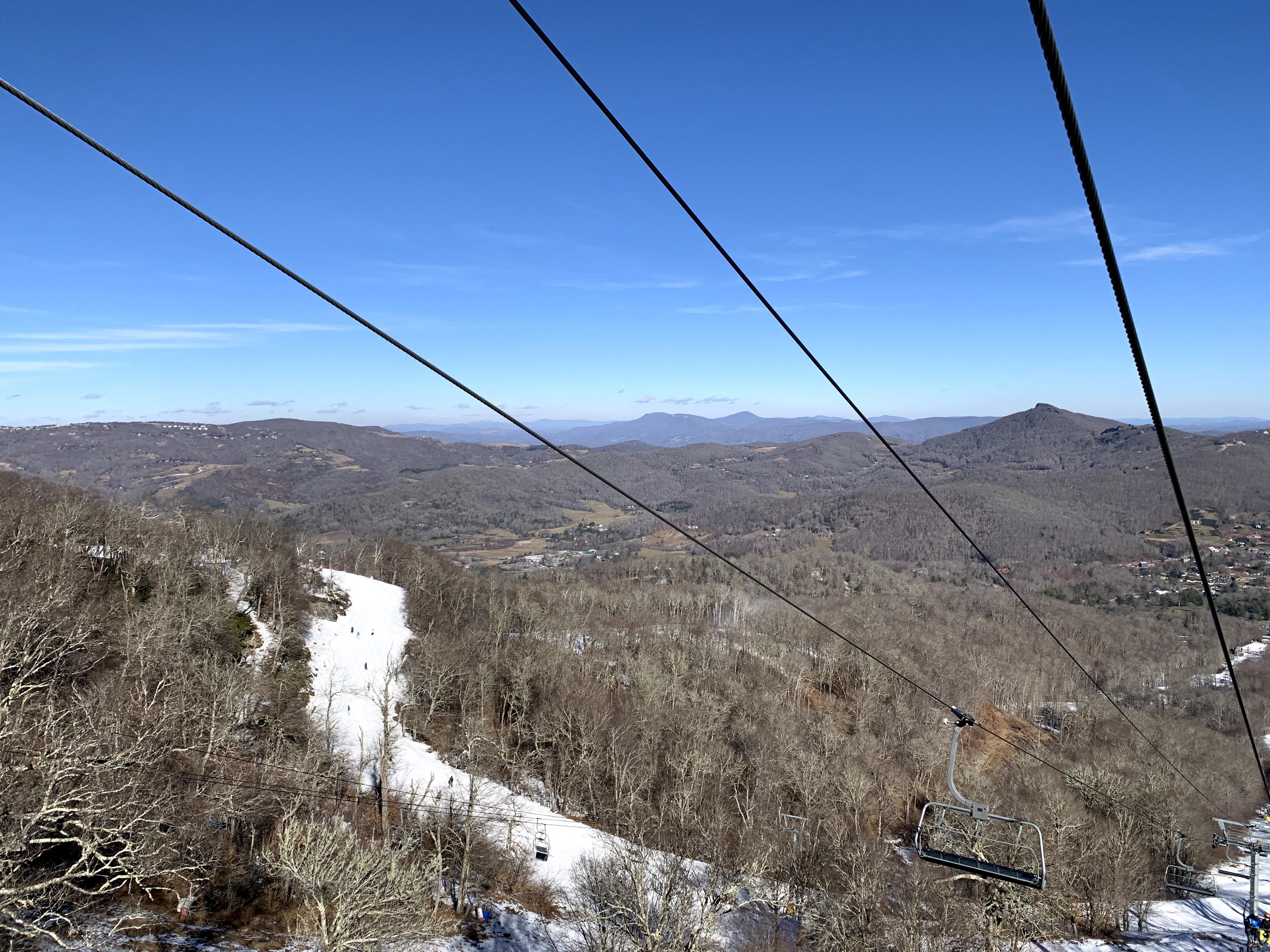
Sugar Mountain Ski Resort — 119.1 mi, 3h 00m
Rent skis from one of the places in Banner Elk, like Highland Mountain. Much cheaper than at the mountain and you won’t spend time waiting in line. Google Maps
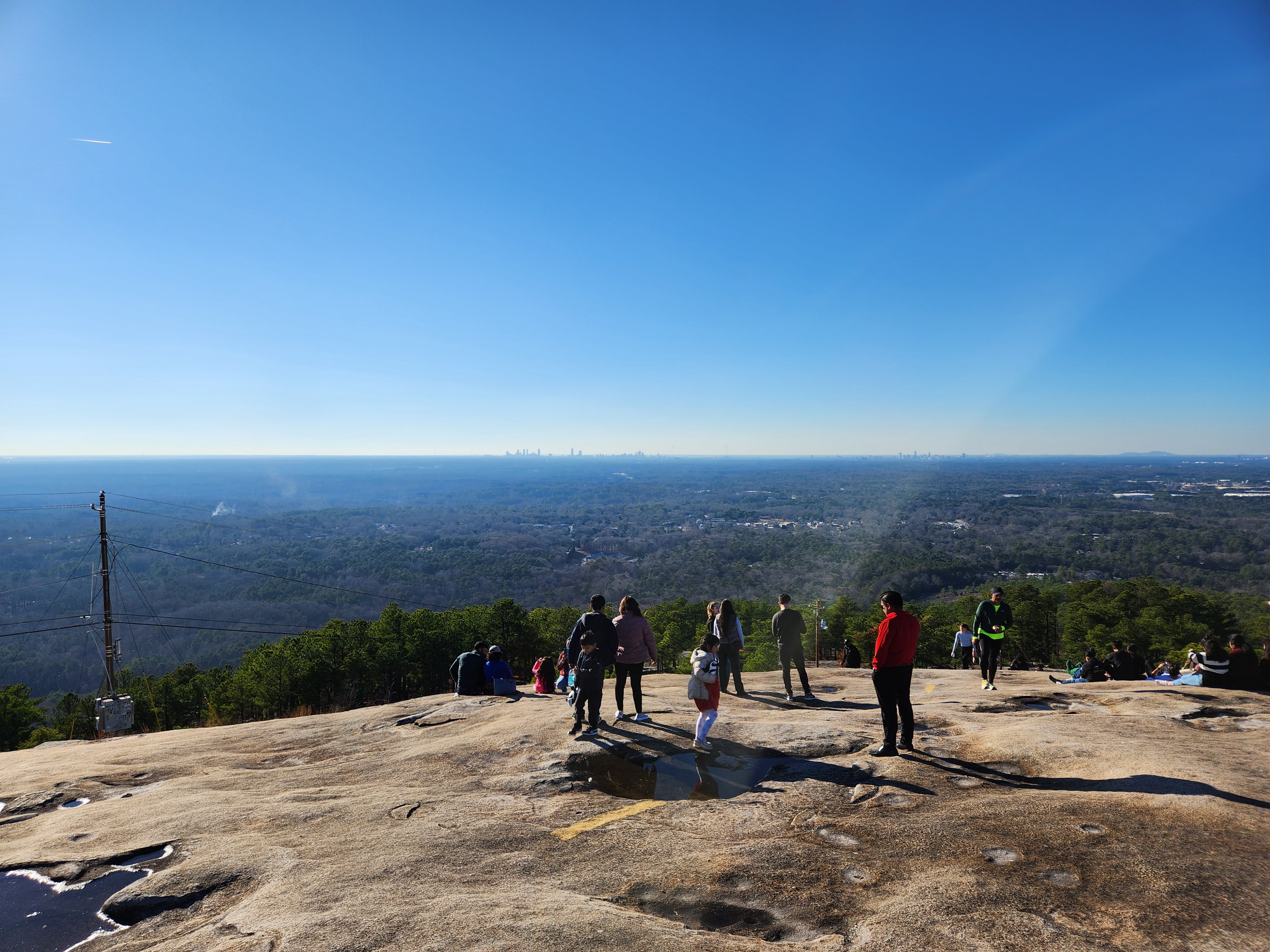
Stone Mountain — 136.7 mi, 2h 41m
Features a massive granite dome, a 600-foot waterfall, and a historic homestead. The loop trail offers incredible views from the summit of the mountain. Google Maps
Family Fun
Georgia Aquarium — 144.2 mi, 2h 47m
One of the largest aquariums in the world, featuring whale sharks, manta rays, and thousands of other marine species in massive, immersive galleries. Google Maps
Arts & Culture
NASCAR Hall of Fame — 101.0 mi, 2h 03m
Located in Charlotte, this high-tech venue honors the history and heritage of NASCAR through interactive exhibits and historic racing simulators. Google Maps
SC Confederate Relic Room and Military Museum — 102.9 mi, 1h 57m
Columbia-based museum covering SC military history from the Revolutionary War through the present. Extensive flag, uniform, and weapon collections. Google Maps
World of Coca-Cola — 144.0 mi, 2h 47m
An Atlanta staple where you can learn the history of the world’s most famous beverage and sample over 100 different drinks from around the globe. Google Maps